
are geological-geophysical vertical sections or maps of isolines of presented attributes or 3D views on the presented field of data. There are required geotechnical parameters marked. Results are available in optional save (usually AUTOCAD *.dwg) on CD.
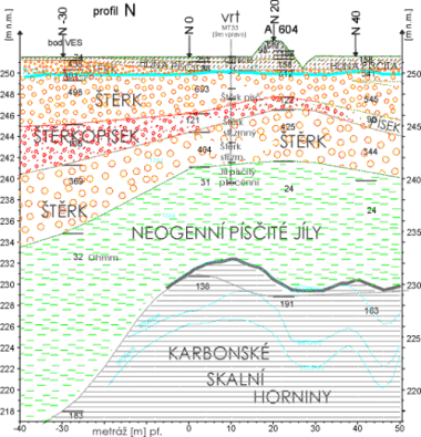
An example of a geological-geophysical vertical section:
There was a complicated geological situation verified by a drill hole on the profile of this section (by MRS – by blue line, VES – by red line and MK). (abbreviated, simplified)