This map of pond deposit thickness was created according to results of GPR measurement and two mechanical penetration probes. (Simplified)
(Simplified)
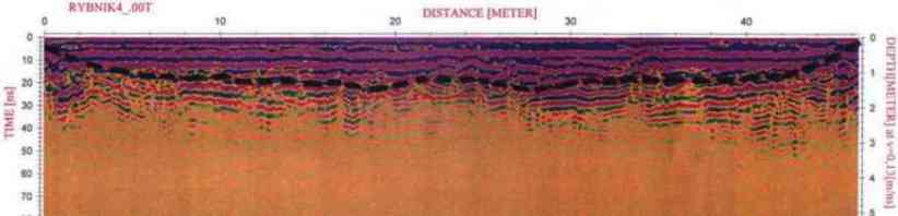
An example of georadar section - bed of pond deposits marked by black dash line.
![a fishpond deposit thickness map [cm]](images/mocnostNanosuRybnikIsol.jpg)