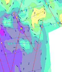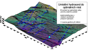
LEGEND:

-map of contour line of altitude of the bedrock surface by shallow refraction seismics. Depresions are toned to the violet color.
+++ -blue crosses mark the geophone positions – the presented information is most credible is those points and among them it was interpolated..
-yellow circles mark crossings of discovered conductive lines with profiles of combined resistivity profiling (the greater is the radius of circele the more noticable is the anomaly. Areas with conductive antropogenous lines was omitted.
-red line connects most probable correlation of possible tectonic lines (seismics and resistivity profiling)
-black circles mark optimal positions for water collecting boreholes (by VES, seismics and resistivity profiling)
Water collecting boreholes was successfull (1 and 3 l / s)
(simplified)
